


VERNET col de Mariaud le tour des villages abandonnés o

RobinMicheline
User GUIDE

Length
15.8 km

Max alt
1823 m

Uphill gradient
1020 m
Km-Effort
28 km

Min alt
1206 m

Downhill gradient
475 m
Boucle
No
Creation date :
2019-08-17 04:24:09.355
Updated on :
2020-01-07 17:45:16.894
7h54
Difficulty : Difficult

FREE GPS app for hiking
 SityTrail
IGN / Geographical institutes
SityTrail Plus
The world is yours!
About
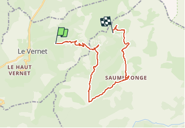
Trail Walking of 15.8 km to be discovered at Provence-Alpes-Côte d'Azur, Alpes-de-Haute-Provence, Le Vernet. This trail is proposed by RobinMicheline.
Description
pie fourche vivre saumonée la immergée refuge Val pouvant 15 kms 900 me dénivelé 480 me descente 5 h marche bien à refaire
Photos

Positioning
Country:
France
Region :
Provence-Alpes-Côte d'Azur
Department/Province :
Alpes-de-Haute-Provence
Municipality :
Le Vernet
Location:
Unknown
Start:(Dec)
Start:(UTM)
293114 ; 4906106 (32T) N.
Comments